
Page 173 - UNESCO_Zatec_2021_A4
P. 173
is a negligible number: Rokycany (6), Chomutov (3), a long period in historical sources (A more detailed
Plzeň-sever (2). There are a total of 406 cadastral areas. description of the territory selected for nomination is
Valuable units of the hop growing landscape can be given in Chapters 2.a and 2.b and is not repeated here).
defined in all three hop growing regions. However, none
of them is comparable to the Žatec landscape in the river The territory of this hop growing region is relatively
Ohře floodplain either in scope or concentration, but large. When choosing the rural component part 01, the
especially in age. primary consideration was the quality of the area, the
concentration of hop fields and the documented length
For map of the Saaz hop growing region based on of hop cultivation. In the Saaz hop growing region, it is
cadastral areas inscripted on the list of the Geographic possible to define other valuable hop field landscapes,
Indications of European Union see Chapter 7.b2. however, none have all the important attributes of
the nominated territory. This is evidenced by the
testimony of cartographic sources. Ročovsko area on
OVERVIEW OF LOCATIONS COMPARED IN DIFFERENT the northern side of the Džbán Highlands was chosen
HOP GROWING REGIONS for a detailed test that confirms these conclusions:
CZECH REPUBLIC Unlike the wide floodplain of the river Ohře, the
ŽATECKÁ (SAAZ) HOP GROWING REGION (1.) landscape of the Ročovsko area is shaped quite
The nominated property was selected from the most differently. It consists of a system of parallel, deeply
fertile hop growing location of the whole region, situated cut valleys, separated by flat ridges, largely still
in the Valley of the stream Blšanka, also called the Zlatý forested. Of all the hop field landscapes in our country,
potok (Golden creek). The basis for the uniqueness of the landscape of this area is the most remarkable. The
the hops in the Žatec region are the specific natural developments by means of which this area - part of
conditions. This area is protected from the north-west by the Podlesí hop growing locality within the Saaz hop
the Ore Mountains, the Doupov Hills and the Bohemian growing region – became a hop field landscape is also
Central Mountains, which create a so-called rain shadow. very interesting.
The landscape context of the proposed property is The centre of this landscape is a small town, founded
th
demonstrated by the rural component part 01, with its in the mid-14 century near an existing fortress. The
hop fields located in the most fertile locations of this hop town was first called Bor, Dráčov, Vysoká obec, and 173
growing region. History shows that the area of hop fields in only since 1470 is the name Ročov (from the fortress)
the Žatec region has changed significantly several times, documented. In the valley below it, a monastery of
but the selected area represents the most permanent, Augustinian hermits was founded in 1373 with a Church
centuries-old location, depicted and described over of the Assumption of the Virgin Mary.
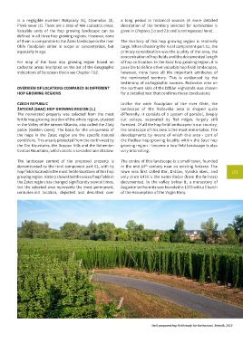
Well-prepared hop field ready for the harvest, Stekník, 2019